A mass of dust has arrived by the Pyrenees since Thursday, May 1, and will extend over a large part of the country this Saturday and Sunday.
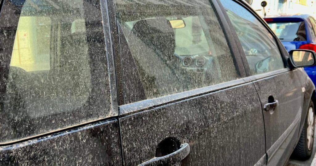
A thin dust film could cover cars this weekend. An important cloud of sand from the Sahara has been flying over the country since Thursday, May 1. Arrived by the Pyrenees, he will extend over a large part of the country this Saturday and Sunday, especially in the south and east.
According to the weather channel*, this cluster of sand coming from Portugal would be “Linked to the Saharan air rise which mixes with rain ». This Saturday, he should fly over a large half of the country, from Perpignan to Nice by going back by Lyon, Strasbourg, Paris and Lille. At the end of the day, the cloud will dissipate to the north but will always be very present from the Alps to the southeast.
The cloud will dissipate this Monday
Sunday, desert dust will continue to spread in Occitanie, Auvergne Rhône-Alpes, Provence-Alpes-Côte d´Azur and Corsica. They will gradually dissipate. On Monday, only Corsica and the PACA region will always be affected. The cloud will then continue to south-eastern Europe.
Voile and milky sky
At the passage of the cloud, the sky is veiled and milky. Brown or orange dust can be visible on vehicles or outdoor furniture, as well as on the snow which would not have yet melted at altitude. With the rain and the thunderstorms expected this Saturday everywhere in France, particle deposits could increase.
In addition to heat, the Sahara particle cloud also causes ozone pollution. In the spring, the rise in Saharan dust is not uncommon. Very recurring southern flows promote massive lifts at the end of winter.
*The weather channel is a company in the Figaro group.


