After a remarkably soft, even hot week on Western Europe (Paris broke its daily warmth record on May 1), time will end up getting off this weekend, with stormy degradation that will concern most of France, including our regions. What should be expected in terms of temperatures next week, and why will we first have difficulty observing a clear increase in the thermometer? We explain everything to you.
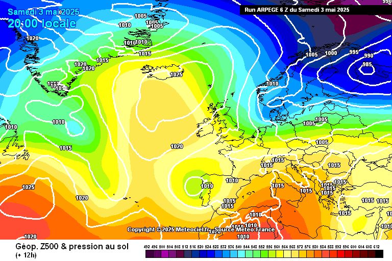
1) A situation blocked by a cold drop
It is still his fault. In the spring, they are queens of the atmosphere. The cold drops are back. These are small depressions, isolated in high pressure, and which disturb the beautiful spring conditions. As a reminder, a cold drop is therefore a system of low pressures which detaches from a large depressional system of polar origin. When the “cut-off” forms (when the detachment takes place), the cold drop park on lower latitudes, disturbing the reign of a subtropical anticyclone. They take place mainly in the spring, when polar disturbances are still present and have enough influence, before they dissipate with the arrival of summer.
For the coming situation, this cold drop (which is off Portugal this Saturday), will come to France, influencing more gray conditions, temporarily disturbed, and cooler. Throughout the week, this little depression will park on us, and will not really move. Some signs of weakening the cold drop, with a strengthening of the anticyclone, are possible from Friday, with the return of conditions perhaps warmer, before a new cold drop arrives by the near Atlantic.
2) point on temperatures
As of Monday, under dominant cloud conditions, accompanied by a mistral and a tramontane, the mornings are still soft, but the maximum temperatures will be down brutal. Under the clouds, there is no more than 18 to 19 ° C on the plains, up to 22 ° C on the Biterrois, which will be able to observe some clearings. On the mountains, the cold shower is even more brutal since we can observe maximums of 7 ° C, or even 6 ° C on the Margeride. Tuesday, the thinnings can be more frank, which will win some small degrees on the coastal plain. It will be 20/21 ° C on average, locally 22 ° C on the Rhône Delta. On the Cévennes, under the clouds, the freshness remains in place with always maximums around 6 ° C. The situation promises to be similar for Wednesday.
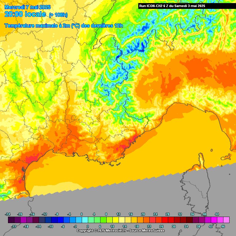
Thursday, May 8, under a clear sky, we will see the reappearance of the frosts in Lozère and the countryside will also be very cool in the morning (sometimes around 4 ° C in devented conditions). “In May, do what you like”, but with common sense all the same! The maximums remain stationary compared to the previous days. As of Friday, with the swelling of the anticyclone, we can experience an increase in the thermometer with 21/22 ° C, loc. 23 ° C on the plain. For the weekend, the increase in the thermometer continues on its momentum, with the return of 25 ° C to the plains.
In conclusion, the cold drop does only in its head for the coming week, but the anticyclone did not say its last word for the following weekend.
Facebook Twitter Google+


