A rain of a striking abruptness and many lightnings swept through Paris and its surroundings, Saturday May 3 around 4 p.m. Holders quickly lined the white pavement, causing some material damage and problems in transport.
A dark sky, broken water and lightning. The Parisians were surprised on Saturday May 3, by a very violent storm which fell on the capital and part of the Ile-de-France around 4 p.m. The storm was notably marked by the fall of large hailstones at the comparable size, for some, to ping-pong balls. According to the weather channel, cited by Le Figarothe temperature increased from 27 to 15 ° C in a few minutes. The phenomenon lasted ten minutes before a return to calm.
The storm then moved to the Rhône-Alpes region. After Paris, the Lyon metropolis in turn wiped the strong hail around 5.30 p.m. Earlier in the day, Météo France had placed almost all of the country in yellow vigilance violent thunderstorms. And half of the departments will remain so on Sunday, May 4.
Disrupted transport, fell trees
In Paris, several streets and metro stations have been flooded, causing delays in public transport and the closure of certain stations. The metro lines 2, 3, 6, 7 and 9 were impacted with closed stations. At 7:45 p.m., lines 3 and 9 were still affected, with the Porte de Champerret, Alma-Marceau and Voltaire stops.
-Motorists were also surprised, reports the Sytadin site, relayed by The Parisianwith a combination of traffic jams on the Ile -de -France roads at the time of the storm. On the SNCF side, some power cuts without consequences on traffic have been noted.
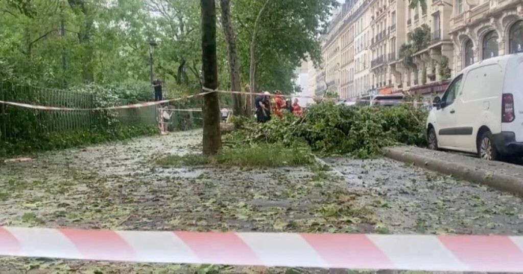
In terms of material damage, the Paris firefighters brigade identified in Paris and its small crown about thirty interventions during the afternoon, said The Parisianstating that it was mainly of fallen trees, water leaks and materials in the process of falling. Cars as well as the terraces or storefronts of many traders have also suffered damage, but, despite the violence of the hail down, no incident involving a person is to be deplored.
Disturbances on a large part of France, which should continue on Sunday
Earlier in the day, first stormy rains had taken place in western France, especially in the Channel, Orne and Eure. After Paris in the middle of the afternoon, the storm continued towards Bordeaux, the Pays de la Loire and the Rhône-Alpes region. The Lyon metropolis was also affected by a high rain of hail, which occurred around 5.30 p.m.
Almost all of the country remained, on Saturday, placed in yellow vigilance “thunderstorms” until midnight. Sunday, May 4, the alert was lifted for half of France, but the departments located under a diagonal from the Gironde to the Meuse will remain classified in yellow. The unstable time should first concern the Pays de la Loire and the Grand Est, then extend south. Storms will risk occurring Sunday afternoon from the Pyrenees to the Massif Central, as well as in the Rhône-Alpes region.


