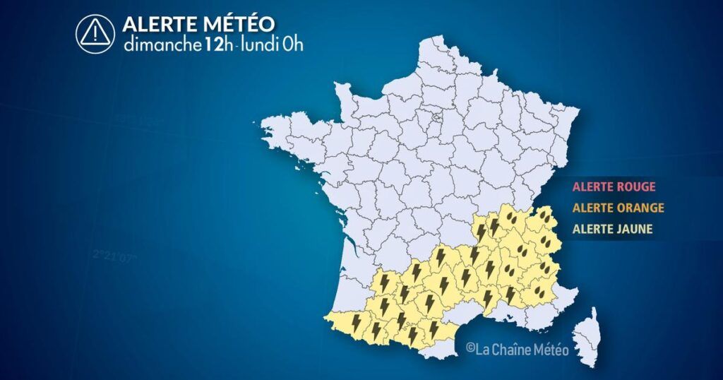
Of
Sunday, May 4 at 12:00:00 au
Monday May 5 at 0:00
Situation
The summer time ends this weekend under the effect of a conflict of air masses between current heat and the arrival of a northeast flow from northern sea. After the thunderstorms of yesterday in the north of the country, the disturbance descends south and comes to block from the Pyrenees to Auvergne-Rhône-Alpes to the Mediterranean hinterland where it causes storms punctually strong and abundant rains.
Observation
This Sunday at 3 p.m., The situation deteriorates very quickly with the multiplication and strengthening of the pyrenees thunderstorms in Languedoc at the Massif Central in Rhône-Alpes. The strongest thunderstorms are observed on the Pyrenean foothills with hail, but also Languedoc and Cévennes in Puy-de-Dôme as well as in the Val de Saône, between Mâcon and Dijon. These thunderstorms are punctual, but they can intense precipitation, as happened between 1 and 3 p.m. in Lavaur (81) where it fell 41 mm of rain in 2 hours.
Evolution
This Sunday:
Regions concerned: from the Pyrenees to Rhône-Alpes via Occitanie.
Risk period: from Sunday 9 a.m. to Monday 0 a.m.
Settings: strong cumulative rain (Rhône-Alpes, up to 80 mm of water in 24 hours). Wind gusts at 80 km/h.
Before and during the storm episode
– Avoid non -essential trips during risky periods.
– Return or secure exterior objects (garden furniture, flower pots, parasols …) to prevent them from being carried away by the wind.
– Shelter your vehicle, if possible, to limit the damage in case of hail.
– Log away from trees, metallic structures and watercourses during the thunderstorm.
In case of heavy sudden rains
– Never engage in a flooded road, even partially.
– On the road, reduce your speed, increase the safety distances, and beware of gusts under thunderstorm.


